graphite showing, Gurambira, Hwange District, Matabeleland North, Zimbabwei
| Regional Level Types | |
|---|---|
| graphite showing | - not defined - |
| Gurambira | - not defined - |
| Hwange District | District |
| Matabeleland North | Province |
| Zimbabwe | Country |
This page is currently not sponsored. Click here to sponsor this page.
Key


Latitude & Longitude (WGS84):
18° 26' 41'' South , 26° 52' 7'' East
Latitude & Longitude (decimal):
Köppen climate type:
Nearest Settlements:
| Place | Population | Distance |
|---|---|---|
| Dete | 2,993 (2013) | 19.1km |
| Kamativi Mine | 1,575 (2012) | 24.5km |
| Hwange | 33,210 (2014) | 40.0km |
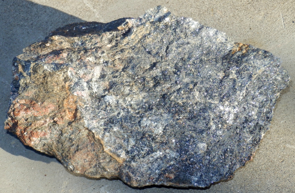
A small graphite showing in the village of Gurambira, just behind the bottle store. Strongly folded gneisses contain graphite rich layers and calc-silicate layers.
Select Mineral List Type
Standard Detailed Strunz Dana Chemical Elements
List of minerals arranged by Dana 8th Edition classification
| Group 1 - NATIVE ELEMENTS AND ALLOYS | |||
|---|---|---|---|
| Semi-metals and non-metals | |||
| ⓘ | Graphite | 1.3.6.2 | C |
References
Sort by
Year (asc) Year (desc) Author (A-Z) Author (Z-A)Wolfgang Hampel, site visit 7 June 2014.
Other Regions, Features and Areas containg this locality
African PlateTectonic Plate
This page contains all mineral locality references listed on mindat.org. This does not claim to be a complete list. If you know of more minerals from this site, please register so you can add to our database. This locality information is for reference purposes only. You should never attempt to
visit any sites listed in mindat.org without first ensuring that you have the permission of the land and/or mineral rights holders
for access and that you are aware of all safety precautions necessary.


graphite showing, Gurambira, Hwange District, Matabeleland North, Zimbabwe