Strawberry Butte, Jefferson County, Montana, USAi
| Regional Level Types | |
|---|---|
| Strawberry Butte | Table/Butte |
| Jefferson County | County |
| Montana | State |
| USA | Country |
This page is currently not sponsored. Click here to sponsor this page.


Latitude & Longitude (WGS84):
46° North , 112° West (est.)
Estimate based on other nearby localities or region boundaries.
Margin of Error:
~53km
Type:
Köppen climate type:
Mindat Locality ID:
105587
Long-form identifier:
mindat:1:2:105587:3
GUID (UUID V4):
53b27c77-ffd0-489e-8fed-b26f5c4e2b47
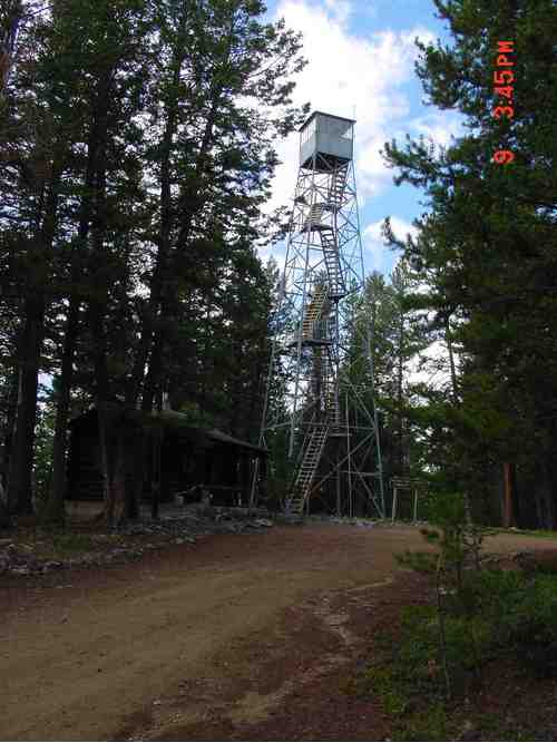
Strawberry Butte is a tertiary topaz rhyolite emplacement located about 10 miles south of Helena, Montana. The rhyolite is not exposed in the collecting area, but weathered talus on the slopes near the top of the butte (adjacent to the lookout tower) are composed of cobbles and boulders of the rhyolite. The rhyolite contains numerous lithophyseal cavities mostly containing tiny (<1 mm) quartz crystals with some containing small (2-5mm long) pale blue topaz crystals.
The access road to the summit is usually locked, however, access can be gained by visiting the ranger station near the Helena airport. After signing a release form, the station will supply collectors with a key to the access road gate.
Select Mineral List Type
Standard Detailed Gallery Strunz Chemical ElementsGallery:
List of minerals arranged by Strunz 10th Edition classification
| Group 4 - Oxides and Hydroxides | |||
|---|---|---|---|
| ⓘ | Quartz | 4.DA.05 | SiO2 |
| Group 9 - Silicates | |||
| ⓘ | Topaz | 9.AF.35 | Al2(SiO4)(F,OH)2 |
List of minerals for each chemical element
| H | Hydrogen | |
|---|---|---|
| H | ⓘ Topaz | Al2(SiO4)(F,OH)2 |
| O | Oxygen | |
| O | ⓘ Quartz | SiO2 |
| O | ⓘ Topaz | Al2(SiO4)(F,OH)2 |
| F | Fluorine | |
| F | ⓘ Topaz | Al2(SiO4)(F,OH)2 |
| Al | Aluminium | |
| Al | ⓘ Topaz | Al2(SiO4)(F,OH)2 |
| Si | Silicon | |
| Si | ⓘ Quartz | SiO2 |
| Si | ⓘ Topaz | Al2(SiO4)(F,OH)2 |
Other Regions, Features and Areas containing this locality
North America
- Rocky MountainsMountain Range
North America PlateTectonic Plate
- Great Falls DomainDomain
This page contains all mineral locality references listed on mindat.org. This does not claim to be a complete list. If you know of more minerals from this site, please register so you can add to our database. This locality information is for reference purposes only. You should never attempt to
visit any sites listed in mindat.org without first ensuring that you have the permission of the land and/or mineral rights holders
for access and that you are aware of all safety precautions necessary.


Strawberry Butte, Jefferson County, Montana, USA