 | | Report (issue) | | Prepared in cooperation with the Iowa Department of Transportation and Iowa Highway Research Board (Project...South Skunk River Basin, Central and Southeast Iowa IOWA South Skunk River Basin Open-File Report 2012–1202...Southeast Iowa By Kimberlee K. Barnes and David A. Eash Prepared in cooperation with the Iowa Department...Department of Transportation and Iowa Highway Research Board (Project HR-140) Open-File Report 2012–1202 U...the South Skunk River Basin, central and southeast Iowa: U.S. Geological Survey Open-File Report 2012–1202 |  | | Report (volume) | | ..'........................................ 126 Iowa...................................................Barrett, Indianapolis. Iowa___ __Prof. George F. Kay, Iowa City. Kansas_____Prof. Erasmus Haworth, Lawrence...See Bauxite and Halloysite. Asbestos. Tallapoosa County, with corundum deposits near Dudleyville; not found...commercial quantity or quality. Asphalt. Colbert County, small quantity has been shipped from near Leighton;...following localities : Bibb County, Pratts Ferry; Calhoun County, near Tampa; Clay County, T. 20 S., R. 7 E.; |  | | Report (volume) | | Edward Barrett, Indianapolis. Iowa.............. Prof. George F. Kay, Iowa City. Kansas............Prof...See Bauxite and Hallpysite. Asbestos. Tallapoosa County, with corundum deposits near Dudleyville; not found...commercial quantity or quality. Asphalt. Colbert County, small quantity has been shipped from near Leighton;...following localities: Bibb County, Pratts Ferry; Calhoun County, near Tampa; Clay County, T. 20, Pv. 7 E.; Jefferson...Jefferson County, at Elyton; Lee County, at Chewacla lime works; St. Clair County, at Gfeensport; Shelby |  | | Book (edition) | | mmed at Broken Arrow aud Trout creek, in Sc. Clair county. The strata in this field are more faulted und...prong of Canoe creek, in St. Clair county, to Ha\sop creek, in Bibb county, a distance of 60 miles. Down to...to Helena, in Shelby county, the field has an average width of 5 or 6 miles. Below that point the width...miles being in the latitud" of Blocton, in Bibb county. The south ern end of this field has a greater...Jefferson county; Helena, Montevallo, and Brierfield, Shelby county; and at Blocion. Bibb county. The Warrior |  | | Journal (article/letter/editorial) | | concerned, is that which stretches from north central Iowa across portions of Missouri, Nebraska, Kansas, Arkansas...of the field; that portion extending from central Iowa to southwestern Kansas. The first extensive investigations...the succeeding reports of 'Geol. Surv. Wisconsin, Iowa, and Minnesota, 1852. 2Geol. Surv. Missouri, I and...1891. Iowa Geol. Suiv., Vol. I, p. 85, 1893. 577 578 H. F. BAIN AND A. G. LEONARD the Iowa and Missouri...while during the latter the whole of southwestern Iowa, northwestern Missouri, eastern Kansas, and probably | | | Report (issue) | | with the IOWA DEPARTMENT OF NATURAL RESOURCES, IOWA GEOLOGICAL SURVEY; and the UNIVERSITY OF IOWA HYGIENIC...Water Used for Selected Municipal Water Supplies in Iowa, 1997–2002 Water Years Open-File Report 2004–1048...Supplies in Iowa, 1997–2002 Water Years By Gregory R. Littin Prepared in cooperation with the Iowa Department...Department of Natural Resources, Iowa Geological Survey, and the University of Iowa Hygienic Laboratory Open-File...water used for selected municipal water supplies in Iowa, 1997–2002 water years: U.S. Geological Survey Open-File |  | | Report (issue) | | PERMITTED WATER USE IN IOWA, 1985 By D. L. Runkle, J. L Newman and E. M. Shields U.S. GEOLOGICAL SURVEY...cooperation with IOWA DEPARTMENT OF WATER, AIR AND WASTE MANAGEMENT and the IOWA GEOLOGICAL SURVEY Iowa City, Iowa...Iowa 1985 For additional information write to: District Chief U.S. Geological Survey, WRD P.O. Box...Federal Building 400 South Clinton Street Iowa City, Iowa 52244-1230 UNITED STATES DEPARTMENT OF THE.................................... 2 Aquifers in Iowa ........................................ 2 Total |  | | Journal (article/letter/editorial) | | to States that are dry and hot. provide Lehigh County minerals that may Robert Middleton of the American...American Mu be placed on display at the Lehigh County seum of Natural History told of mineral courthouse...Qub of guest speaker for the Bergen County Min Lower Bucks County, Fairless Hills, was eralogy and Paleontology...specimens, etc., for the Society, and the Bucks County Earth club to dispose of at bargain rates. The...Member Bill Ash told of Soapstone Ridge in DeKalb County, Ga. There is evidence that prehistoric Americans |  | | Book (volume) | | Virginia VOLUME 3: THE NORTHWESTERN QUANDRANT Idaho, Iowa, Kansas, Minnesota, Missouri, Montana, Nebraska...TREASURES VOLUME ep The Northwestern Quadrant Idaho, Iowa, Kansas, Minnesota, Missouri, Montana, Nebraska...volumes, through very precise directions and accurate county maps, to get you to the best and most accessible...for the county in which it is located. This site number also appears under the given county in the text...under the heading of Nebraska, on the map of Sioux County, the site x How to Use This Book indicated |  | | Report (volume) | | Hood County.............. Abbott; village on Missouri, Kansas and Texas Railway in Hill County.........post village in Collingsworth County. Aberfoyle; post village in Hunt County. Abilene; city on Texas and...and Pacific Railway, the county seat of Taylor County; population 3,411...................... Abner; village...village in Kaufman County. Acme; village in Hardeman County. Acona; village in Guadalupe County. Acton; post...village in in Hood County...................... Ada; post village in Montgomery County. Atlas sheet. Granbury |  | | Journal (article/letter/editorial) | | left). Calcite, 5.5 cm high, Elmwood mine, Smith County. Terry Huizing specimen, Jeff Scovil photo. Figure...(above). Fluorite, 13.1 cm wide, Elmwood mine, Smith County. Francis Benjamin specimen, Jeff Scovil photo....Smith County. Terry Huizing specimen and photo. Figure 4 (right). Cumberland mine, Smith County. Travis...earths to make saltpeter, at Nicojack Cave in Marion County, then nitromagnesite at the same location (Shepard...Sevier County (Coskren and Lauf 2000). The following index is arranged alphabetically by county. It is |  | | Report (issue) | | ESTIMATED WATER USE IN IOWA, 1985 By Melanie L. Clark and Joanna N. Thamke U.S. GEOLOGICAL SURVEY Open-File...in cooperation with the IOWA DEPARTMENT OF NATURAL RESOURCES Iowa City, Iowa 1988 For additional information...Division 400 South Clinton Street P.O. Box 1230 Iowa City, Iowa 52244-1230 DEPARTMENT OF THE INTERIOR DONALD.....................................2 Aquifers in Iowa ..................................................hydrologic unit subregions....................3 County map showing total estimated water use......... | 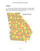 | | Book (volume) | | Dahlonega Co. and Rabum Co., and the McDuffie County Belt extending through portions of McDuffie, Warren...Sphalerite. BALDWIN COUNTY MILLEDGEVILLE, at state farmjasper. BANKS COUNTY COMMERCE, along Hwy. 59...along adjoining Co. linerock crystal. BARROW COUNTY WINDER, along rd. to Jefferson and 1½ mi. inside...in the United States BARTOW COUNTY AREA, Saltpeter Cave, as floatjasper. CARTERSVILLE: area barite...the vicinity of Cartersville and Cave Springs (NW Polk Co. and 147 Georgia SW Floyd Co.). E 1 mi., |  | | Journal (issue) | | Colorado School of Mines Geology Museum, The Boulder County Tungsten District and its History, by Ed Raines...Elick, WMMI and Middle School student, Douglas County School District. Doors open at 6:00 p.m., lecture...Rockhound Club Gem & Mineral Show, at The Ranch/Larimer County Fairgrounds, Thomas M. McKee 4-H Building, 5280...the Mona Lisa Mine on Little Porter Mountain, Polk County Arkansas. This image should be recognizable...the White Cap Pocket, Smoky Hawk Claim, Teller County, Colorado. Display by Collectors Edge. This is |  | | Report (volume) | | Atlas sheet. Abbey; bend in Brazos River in Hood County................ Granbury. Abbott; village on Missouri...Missouri, Kansas and Texas Eailroad in Hill County ................................................. Waco...post village in Collingsworth County. Aberfoyle; post village in Hunt County. Abilene; city on Texas and...and Pacific Railroad, the county seat of Taylor County; population, 3,411 ...................... Abilene...Kaufman County. Acme; post village in Hardeman County. Acona; post village in Guadalupe County. Acton; |  | | Report (issue) | | Highways 24 and 61, 5 miles north of Palmyra, Marion County. Lat 39°52'29", long 92°01'26, in NFANW\; sec...Shelby County. Lat 39°53'50", long 91°34'50", in SW^NW^ sec. 21, T. 59 N., R. 6 W., at county highway...highway bridge, 4.5 miles southwest of Taylor, Marion County. Lat 39°56'05 1< , long 91°31'35", in NE^SE^ sec...R. 6 W., at U.S. Highway 61, at Taylor, Marion County. Lat 40°05'37", long 91°44'08" in SE?u sec. 12...Highway 16, 2.5 miles southwest of Mo/iticello, Lewis County. Lat 40°19'55' : , long 92°12'50", in NVAjNWo |  | | Report (issue) | | WORKED AREA OF THE REED MINE, NEAR CEDARTOWN , POLK COUNTY, GEORGIA. GEOLOGICAL SURVEY OF GEORGIA W. S...PRELIMINARY REPORT ON A PART OF THE IRON ORES OF POLK, BARTOW AND FLOYD COUNTIES BY S. W. l'vlcOALLIE...FURNACES OF POLK, BARTOW AND FLOYD 29 DESCRIPTION OF THE IRON ORE PROPERTIES OF BARTOW COUNTY . X 27...27 DESCRIPTION OF THE IRON ORE PROPERTIES OF POLK CouNTY. IX rs THE MODE OF OCCURRENCE OF THE BROWN... DESCRIPTION OF THE IRON ORE DEPOSITS oF FLOYD CouNTY . I77 LETTER OF TRANSMITTAL GEOLOGICAL SURVEY |  | | Journal (issue) | | Curry County Sec. 36 T. 40 S., R. 11 W. Bowers Mill Dana W. Bowers Medford, Ore. Josephine County Sec...Ore. G rant County John Day Foster Mill Ernest Foster Grants Pass, Ore. Joseph i ne County Sec. 28 T...Josephine County NW "F" Street Grants Pass John Day Mining Co. John Day, Ore. Grant County Sec. 26 T...Corporation Riddle, Ore. Douglas County Canyonvi lie Lyman and Grant County Findlay Mill John Day E. Lyman... Curry County Sec. 24 T. 38 S., R. lOW. Newman Mill Art Newman John Day, Ore. Grant County John Day |  | | Report (volume) | | Hartselle sandstone, which crops out in Jefferson County in the northeastern suburbs of Birmingham, has...brown iron ore mines, near Woodstock station, Bibb County, is a bed of sand that is also used in steel foundries...1925, Report of certain molding sand resources of Iowa, Kentucky, New Jersey, Pennsylvania, and Wisconsin:...that is used for steel molding. Deposits listed in Iowa and Wisconsin are not of high-purity grade. Anderson...Montgomery Counties [Ark.]: Ark .. Geol. Survey County Mineral Rept. 3, p. 66-74, 87-90. Novaculite is |  | | Book (volume) | | ASHTABULA COUNTY CONNEAUT, area pits, quarries, rd. cuts, etc.⎯cone-in-cone Calcite. CLERMONT COUNTY MILFORD...CLINTON COUNTY WILMINGTON, area of Todd’s Ford, a mineral deposit⎯Hematite. COSHOCTON COUNTY AREA, townships...CUYAHOGA COUNTY CHAGRIN FALLS (on Geauga Co. line), area quarries⎯oilstone. DELAWARE COUNTY DELAWARE...nodules⎯Pyrite (crystals sharply cubic). FRANKLIN COUNTY COLUMBUS, area countywide exposures of blue clay...HIGHLAND COUNTY SINKING SPRING, area ore deposit (most important in Ohio) ⎯Hematite. HOCKING COUNTY AREA |  | | Book (volume) | | ASHTABULA COUNTY CONNEAUT, area pits, quarries, rd. cuts, etc.⎯cone-in-cone Calcite. CLERMONT COUNTY MILFORD...CLINTON COUNTY WILMINGTON, area of Todd’s Ford, a mineral deposit⎯Hematite. COSHOCTON COUNTY AREA, townships...CUYAHOGA COUNTY CHAGRIN FALLS (on Geauga Co. line), area quarries⎯oilstone. DELAWARE COUNTY DELAWARE...nodules⎯Pyrite (crystals sharply cubic). FRANKLIN COUNTY COLUMBUS, area countywide exposures of blue clay...HIGHLAND COUNTY SINKING SPRING, area ore deposit (most important in Ohio) ⎯Hematite. HOCKING COUNTY AREA |  | | Journal (article/letter/editorial) | | knowledge. One lapidary asked i f agate is as hard as jasper. People on the trips kept asking "what are we looking...by the Willamette Agate and Mineral Society. Polk County Fairgrounds, Highway 99W South. Chairman: W....Guild's 3rd Faceters Fair, Gem & Jewelry Show. Lucas County Recreation Center, 2901 Key Street, Exit 4, Ohio...xls, Balmet, L a n c a s t e r C o . , New York, USA—SW: f l . beautiful salmon. LW:1 In the meantime |  | | Report (issue) | | Each article was read, annotated, and indexed by county, subject, and geological age where applicable....geographic area of the subject was. greater than a county, subdivisions of the state, based upon physiographic...Varved sediments from one outcrop in Effingham County, across the Savannah River from Berry's Landing...popular account of the geology of the park in Douglas County. Descriptions of marked sites along marked trails...organic floccules in the Satilla estuary [Camden County] [abstract]: Geol. Soc. America Abs. with Progs |  | | Journal (article/letter/editorial) | | at the Catsburg Store to start a field trip for jasper, agate and calcite. Members Thad Sparks and Miriam...presented a program of his trip "North", that is to Iowa, Wisconsin, Minnesota and Ontario, Canada....amethyst...Newsletter. The Rock and Mineral Club of Lower Bucks County are preparing to publish a booklet detailing the...and artinite. The Junior Section of the Bergen County Mineralogy and Paleontology Society, Paramus, with...in a gravel bed. logic formation. The Tompkins County Gem and Mineral Club, Ithaca, held a picnic, an |  | | Journal (article/letter/editorial) | | 204, Tampa, FL 33620, USA 2 Free Radical Consulting, Seffner, FL 33584, USA Introduction Generalities...the side of a road from Farmington, Connecticut USA had several large metallic grains consisting of mixtures...were recovered from sand mine spoil piles from Polk County, Florida (e.g., Pasek and Hurst 2016); these...Greensboro NC Wink TX Western NY York PA Cline Butte OR Polk FL b Methods General characteristics of reported...sandstones, a carbonate rock, a hematite-bearing jasper, and an agate was measured. Two of the sandstones |
|


Des Moines, Polk County, Iowa, USA