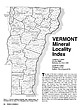
 | | Journal (article/letter/editorial) | | GRAND, ISLE: L Jirrwowwux/ lot* llMt UK* U'A VERMONT Mineral Locality Index VANDALL T. K I N G P.O....Massachusetts 01776 MASSACHUSETTS Figure J. Vermont political divisions map; adapted from U.S. Geological...of New Hampshire and Vermont (1972). 324 ROCKS & MINERALS he state of Vermont is relatively small,...ry in the world is in Rochester (Windsor Co.), Vermont. Min eral products mined "as is" for their final...maintained. (The disuse of cobblestone roads prevents Vermont from being a giant mining state today, but in the |  | | Report (volume) | | 589 THE CALCITE MARBLE AND DOLOMITE OF EASTERN VERMONT BY T. NELSON DALE WASHINGTON GOVERNMENT PRINTING..................................... 10 Franklin County.................................................................................... 11 Lamoille County..................................................................................... Washington County......................................................................................... Orange County............................................... |  | | Report (issue) | | University of Vermont BURLINGTON. VT.: FREE PRESS PRINTING 1924. Co. CONTENTS. STAFF OF THE VERMONT GEOLOGICAL...of Vermont. ELBRIDCE C. JACOBS, Assistant Geologist. Professor Mineralogy, University of Vermont. CITA1ILES...PAGE ç ' LIST OF ALTITUDES IN VERMONT, /GEOLOGY OF GRAND ISLE COUNTY, THE OLDEST CORAL REEF, P. E.... TERRANES OF BETHEL, VERMONT, PERKINS .................... G. H. PERKTNS .................... 63...SUCCESSION IN NORTHWESTERN VERMONT, ARTHUR KEITH. NEW TRILOBITES FROM VERMONT, 1 G. H. P. E. RAYMOND |  | | Journal (volume) | | MOUNTAIN GEOLOGIST QUARTERLY NEWSLETTER OF THE VERMONT GEOLOGICAL SOCIETY VGS Website: http://www.uvm...............................................5 VERMONT STATE GEOLOGIST’S REPORT ........................LETTER As I near my 17th anniversary of moving to Vermont, through your votes, I will now take a pull as...possessions in/on a 1982 Toyota Camry, I moved to Vermont from Buffalo, N.Y. to start work in a field area...Having signed the contract before visiting northern Vermont, I overcommitted a bit to the amount of real estate |  | | Report (issue) | | 36 REPORT OF THE VERMONT STATE GEOLOGIST Brick Clays As pointed out by the writer,' there are in the...Deposits and Clay Industry of Vermont; 15th Rpt. Vt. State Geol. (1925-26). VERMONT 1935-1936 I TWENTIETH...GEOLOGIST ON THE MINERAL INDUSTRIES AND GEOLOGY OF VERMONT 193 5-1936 I TWENTIETH OF THIS SERIES I ELBRIDGE...JACOBS F.G.S.A. State Geologist RELIEF MAP OF VERMONT Vermont Mineral Industries The mineral industries...necessary to repeat them here. Marble Production Vermont continues to he the greatest producer of marble |  | | Report (issue) | | GEOLOGIST ON THE GEOLOGY AND MINERAL INDUS1RIE OF VERMONT 1945-1946 I TWENTY-FIFTH OF THIS SERIES Centennial...GEOLOGIST ON THE GEOLOGY AND MINERAL INDUSTRIES OF VERMONT 1945-1946 I TWENTY-FIFTH OF THIS SERIES Centennial...MON, The Vermont Geological Survey: 1844-1946 .......................I STATE OF VERMONT State Geologists...epartnient of Natural Resources, Mont pelier, Vermont, Zadock Thompson ...............................important technical study of the granites of Derby. Vermont. The mineral industries of the state reached new |  | | Report (issue) | | GEOLOGIST ON THE MINERAL INDUSTRIES AND GEOLOGY OF VERMONT 1929-1930 SEVENTEENTH OF THIS SERIES GEORGE H...H. PERKINS State Geologist STAFF OF THE VERMONT GEOLOGICAL SURVEY 1929-1930 GEORGE H. PEinuNs, State...University of Vermont. ELBRIDGE C. JACOBS, Assistant CONTENTS Geologist, University of Vermont. CHARLES...PHYSIOGRAPHY OF VERMONT, G. H. PERKINS ..................... THE aEOLOGY OF VERMONT OCHER DEPOSITS,...107 MOUNT MONADNOCK III VERMONT, J. E. Worr ................... LIST OF VERMONT MINERALS, G. H. PERKINS |  | | Book | | but they may be traced southerly into Litchfield county, where they exist abundantly, and are sometimes...Black Mountain. Thislies ite. A in Dummerston, Vermont, and consists of gran- geologist standing in...beginning at the lop and reckoning dowmcards. I. Zircon sienite. 2. Granite. 3. Porphyry. 4. Sand stone...range which occupies the eastern part of Litchfield County and appears so decided in its characters in Bristol...slate I would mention the eastern part of Halifax. Vermont, also New Fane and Belchertown, two miles north |  | | Book | | Carnelian, Chrysoprase, Jasper, Agate, Chrysoberyl, Zircon, Adularia, Nephrite, Emerald, Beryl, Precious Gar-...of Saratoga in Now York, by Doct. John H. Steel. county A (Steel.') 1822." (N. G.) " New Farmer and... hill, near the lake. (C. C. Baldwin.) 17 VERMONT. ACTON. Hornblende, crystallized in white, ...3 falls, in quartz, crystallized and mas- VERMONT. IS Quartz, limpid, crystallized and amorphous...Carbonate of Lime. k (VERMONT. 19 Ferruginous Quartz, yellow and red, crystallized |  | | Report (volume) | | Bulletin nos. 26, 27; Museum Paper no. 7; County Report no. 1 (Clay County). Montgomery, Ala. Alberta, Scientific...Boletin de Minas, no. 7. Habana, Cuba. Delaware County Institute of Science: Proceedings, vol. 9, no....125. Proceedings, vols. 62-65. Washington, D. C. Vermont Geological Survey: Report of the State Geologist...111. West Virginia Geological Survey: County Reports, Tucker County, Mineral and Grant Counties. Morgantown...S. 6. Geology and mineral resources of McLennan County: Texas, Univ., Bull, no. 2340, 202 pp., 10 figs |  | | Book (edition) | | diluvium, Peculiarities in the Diluvium of Berkshire County, Second Proof (diluvial grooves,) of a southerly...do 304 Micaceous Limestone, 305 : Limestone Whitingham, in Boxborough, Vt. in Bolton, Acton, Carlisle...been greatly aided by the geological map of that county, published a few years since by Professor Dewey...Diluvial tracts of considerable extent exist in the county of Nor- Connecticut valley, and along the western...soil lying above this rock. The range Worcester county, is almost every where overspread with dilu- being |  | | Book | | granitic and darker rocks, pegmatite dikes E. Vermont & N. New Hampshire: mostly Dev., Waits River &...series gneisses THRUST FAULT SLICES OF WESTERN VERMONT Rowe-Hawley slices: Missisquoi, Hawley fms., mostly...marbles & slates fault, undefined type; most in W. Vermont are block (high angle. up-down) faults syncline...“SHELF SEQUENCE” i ES [42| ROADSIDE EOLOGY of Vermont and New Hampshire Bradford B. Van Diver C FR...geology of Vermont and New Hampshire. Bibliography: p. Includes index. 1. Geology — Vermont. 2. Geology |  | | Report (volume) | | 4, 5, 8; Museum Paper, nos. 5, 6; County Report, no. 1 (Clay County). Montgomery, Ala. Alberta, Scientific...Boletfn de Minas, nos. 5-13. Habana, Cuba. Delaware County Institute of Science: Proceedings, vol. 8, no....Ordovician; Silurian; Queen Annes County; Kent County; Talbot County. Baltimore, Md. Mazama, vols. 5 (no...138; Proceedings, vols. 54-74. Washington, D. C. Vermont Geological Survey: Reports of the State Geologist...Geological Survey: (County Reports) Fayette County; Webster County; Nicholas County; Tucker County; Mineral and |  | | Book (volume) | | Contoocook valley which extends through Hillsborough county was thus occupied by a lake during a large part...first volume of this report.* The territory of Vermont extends to the west shore of this river, but in...especially where there is a tributary stream. On the Vermont side the upper terrace, composed of sand or fine...high water. This is a wooded island close to the Vermont side, and forms a north and south ridge 50 feet...wide. The highest terrace, best shown on the Vermont side, is 80 feet above the river; enough of it |  | | Report (volume) | | sandstone. Permian : Central northern Oklahoma (Bay County). C. N. Gould, 1900 (Kans. Univ. Quart., vol. 9...dolomite. Permian : Central northern Texas (Fisher County). M. G. Cheney, 1929 (Univ. Tex. Bull. 2913, p...: Northwestern Colorado (northern part of Eagle County). R. Roth, 1930 (A. A. P. G. Bull., vol. 14, No...Pleistocene and Recent: Northeastern Maryland (Baltimore County). P. R. Uhler, 1901 (Md. Acad. Sci. Trans., n....Upper Devonian : Western New York (Cattaraugus County). G. H. Chadwick, 1923 (Geol. Soc. Am. Bull., vol |  | | Report (volume) | | Bull. 1060-D, p. 193, 252-253, pl. 7. In Nemaha County, Kans., member is basal unit of Howard limestone...Aarde farm, sec. 4, T. 26 S., R. 11 E., Greenwood County. Aaron Slatet Precambrian or Paleozoic: Central...Central Railroad, sees. 5-7, T. 11 S., R. 5 E., Pope County. Named for Abbott Station. Abbyville Gabbrol Precambrian...map. Occurs in vicinity of Abbyville, Mecklenburg County. Abercrombie Formationl Middle Cambrian: Western...above Pope Creek coal. Named for Aberdeen, Butler County, Ky., where it stands out in prominent cliffs along |  | | Book (edition) | | Unaka Mountains, N. Carolina, and E. Tennessee. 5. Zircon-syenyte. A crystalline granular rock consisting...orthoclase, microcline, little hornblende, crystals of zircon, and some elaeolite. Foyayte and Ditroyte are other...by Mather, Columbia slate region of Fig. 89. County, N. Y. Occasionally, the lines of deposition are...Fig. 204. Fig. 205. — by Emmons, from Essex County, N. Y. 1 is hypersthene rock, or hypersthenyte...line, including the Highland Ridge of Dutchess County, N. Y., and'New Jersey, and the Blue Ridge of Pennsylvania | | | Report (volume) | | 5 in., inch or inches. Circ., Circular. Co., County or Company. Indus., Industrial. Inst., Institute...Pre-Cambrian : Central southern Virginia (Mecklenburg County). F. B. Laney, 1917 (Va. Geol. Surv. Bull. 14,...Pleistocene : Southern South Carolina (Charleston County). E. Sloan, 190 (S. C. Geol. Surv. geognostic map...West Virginia, southwestern Virginia (Tazewell County), and eastern Tennessee ( ?). D. B. Reger, 1926...Permian : Central southern Oklahoma (Jefferson County). J. R. Bunn, 1930 (Okla. Geol. Surv. Bull. 4OPP |  | | Book (edition) | | containing little or no (2 b) Zircon-syenyte is a similar rock containing zircon. is it (2.) quartz. called...by Mather, Columbia slate region of Fig. 89. County, N. Y. Occasionally, the lines of deposition are...204. Fig. 205. — Fig; by Emmons, from Essex County, N. Y. 1 is hypersthene rock, or hypersthenyte...line, including the Highland Ridge of Dutchess County, N. Y., and New Jersey, and the Blue Ridge of Pennsylvania...line. The Appalachian ureas commence in Dutchess County, New York, west of Connecticut, and extend south/westward |  | | Journal (volume) | | Spontaneous Combustion , 567 Chili,Export from County ... , Penn... ofMineral Black Band Ore ... Clarendon...Mines ,. any . , Iron Comp Coal Company 55 Clinton County Share Market for June..... Boston 66 Mining 66...Region and its Mines of Lake Superior from Ontonagon County ,... Copper shipped Copral England..... in Suffolk...Pridevale Iron Company , 489 Mineral Deposits in Vermont.. 463 Puddling Furnaces, 577 Mining Prospects on...66 66 227 851 66 Tennessee, Mining in Polk County . Tennessee Copper... Thomson's Chemistry Tolls |  | | Book (edition) | | in place of mica. Zircon-syenite is a syenite or hornblendic gneiss containing zircon with its other constituents...T. S. Hunt to a variety occurring in northern Vermont, and alludes to a resemblance in aspect to serThe...Mather, Colum- Fig. 89. slate region of bia county, JS\Y. Occasionally the lines of deposition are...phlogopite (£ 56), apatite, chondrodite, spinel, zircon, corundum, each of which occurs at times in the...Appalachian chain from the St. Lawrence through western Vermont to Alabama and Tennessee. East of this chain, they |
|


