 | | Book | | Bart Cannon 1975 CORD ILLERAN Mercer Island, Washington Lilli liliiiLt' 111? KLi-KlLLLIlrVlIlI Copyright...Cordilleran 18 Holly Hill Drive Mercer Island, Washington 98040 COVER ILLUSTRATION: Amethyst scepter heads...milky quartz stems. Denny Mountain area of King County. Specimen from the collection of Cary A. Maykut...publications dealing with the various aspects of Washington State's diverse mineral wealth exist, but none..."Minerals of Washington" represents an attempt to begin such a cata logue. "Minerals of Washington" shall |  | | Report (issue) | | mine Radenhurst and Caldwell mine Virgin (Dempseys) Lake celestine mine Tatlock Angelstone quarry Tatlock...Mayo marble quarry Renfrew–Madawaska area Renfrew County Road 4 (Bruce Avenue) roadcut Highway 60 quarry...Meany mine Smart mine Turners Island mine Kuehl Lake occurrence Quadeville East mine Quadeville West...Deady mine Bambrick mine Five Mile mine Spectacle Lake (Lake) mine Plexman mine Davis mine Madawaska River...Bissett Creek mine Deux Rivières outlier Muskwa Lake (Brent) mine 91 91 92 92 94 96 97 97 98 100 100 |  | | Book (edition) | | Bancroft and Region l Old Mines Quarries Outcrops Roadcuts '· Maps • .• ·' f J : .... ! ' Identification...compilation of old mining sites, quarries and roadcuts fmmd in the Bancroft area. The inclusion of a...radius there are numerous abandoned mines, quanies, roadcuts and outcrops that contain dozens of varieties...mine Monmouth XV, lot 28 At Wilberforce, take County Road #4 west 0.6 km from highway 648; take the...of road on right (west) side opposite cottage on lake; proceed for 200 m to the mine. amphibole, calcite |  | | Report (issue) | | from the roadlog of Thompson (1972). In the Orange County copper district, the stops and descriptions in...Hammondville mines (Fe) Skiff Mountain mine (Fe) Paradox Lake mines (Fe) Fort Ann mines (Fe) Metallic mineral...sedimenthosted massive sulfide deposits within the Orange County copper district (the Vermont copper belt) of probable...mixed with chlorite (Zen, 1964). STOP 4-6 50.1 Roadcuts of the West Castleton Formation of Early to Middle...NY. Turn right (north) on Rte 22. 62.6 Large roadcuts in khondalite (sillimanite-garnet-quartz-feldspar |  | Mervine, Evelyn M., Humphris, Susan E., Sims, Kenneth W.W., Kelemen, Peter B., Jenkins, William J. (2014) Carbonation rates of peridotite in the Samail Ophiolite, Sultanate of Oman, constrained through 14C dating and stable isotopes. Geochimica et Cosmochimica Acta, 126. 371-397 doi:10.1016/j.gca.2013.11.007 | Journal (article/letter/editorial) | | Institution, 266 Woods Hole Road, Woods Hole, MA 02543, USA b Geology and Geophysics Department, Woods Hole Oceanographic...Institution, 266 Woods Hole Road, Woods Hole, MA 02543, USA c Geology and Geophysics Department, University of... WY 82071, USA d Lamont-Doherty Earth Observatory, 61 Route 9W, Palisades, NY 10964, USA e Marine Chemistry...Institution, 266 Woods Hole Road, Woods Hole, MA 02543, USA Received 25 June 2013; accepted in revised form 7...at the three roadcuts are 14C dead. An average including veins sampled at both roadcuts and outcrops |  | | Journal (article/letter/editorial) | | Mountain, Trinity County, Calif."—on label. Island Mountain, in the S / W corner of Trinity County, is in N ...finds between Middletown and Meriden on Rt. 6A roadcuts to appear in R&M but so far none. Do you know...Middletown and Meriden are in northern New Haven County in central Connecticut. ILLINOIS—From George A...area."— on label. Niota is in northern Hancock County of western Illinois. INDIANA—"I found a small new... Remington, Ind. Remington, in southern Jasper County, is in N / W Indiana. MASSACHUSETTS—"I am sending |  | | Book | | many years the mines and fields of St. Lawrence County have furnished museums and many lucky mineral col...been depleted through the the years, St. Lawrence County continues to supply many beautiful specimens to...types and mineralized zones of the St, Lawrence County area, A detailed discussion of the geology is beyond...and metamorphic rocks are found throughout the county, the latter prevails. Since more than three-fourths...(metamorphosed gabbro) is present locally across the county. Gabbro is a dark igneous rock composed chiefly | 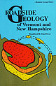 | | Book | | from very salty water, such as Utah’s Great Salt Lake. All seawater contains dissolved sodium chloride...solution. In some places, however, like Great Salt Lake or the lagoons along the Texas Gulf Coast, high...its light color, it can often be recognized in roadcuts by its cavities, formed where openings have been...shatters into jagged fragments when blasted for roadcuts. Slate is a fine-grained, low-grade metamorphic...colors and forms crumpled, slabby outcrops and roadcuts. Phyllite is a slightly higher grade equivalent | 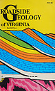 | | Book | | there is more to see and you can stop and inspect roadcuts at your leisure. Maps in this book show only...Tyro, Virginia lineament Spotsylvania D.C. Washington ‘ Plain Coastal Piedmont mi. 80 km. 80 the...Potomac River in Loudon County to the Tennessee-North Carolina border in Grayson County. 4) East of the Blue...centuries ago are quite recognizable today. Except for roadcuts, the Blue Ridge has the same skyline today as...rocks and and dolomite dolomite 6} Mountain Lake Narrows A fault Newport fault Saltville A A |  | | Journal (article/letter/editorial) | | MOUNTAINS, WASHINGTON BY ROBERT J. FOSTER ABSTRACT The Central Cascade Mountains of Washington are composed...east. An eastward-dipping reverse fault through Lake Kachess separates two Tertiary basins of the same...schist Marble and volcanic rocks west of Cle Elum Lake Peridotite and older rocks south of Mt. Stuart Swa...ILLUSTRATIONS 102 Flgure „. Pase 102 21- Index maP of Washington 100 - Teanaway dikes 109 102 3. Rampart Ridge...Geologic map and cross sections, Central Cascades Washington 126 108 108 110 TABLE 110 Table Page 110 1. Diagrammatic |  | | Journal (volume) | | Taconic allochthon ..... 8. Diane Abendroth: Glacial lake-shore levels in the Lamoille Valley, Vermont . ...meet following the awards. A BSTR AC IS GLACIAL LAKE-SHORE LEVELS IN THE LAMOILLE VALLEY, VERMONT Abendroth...education at Ithaca College, American University in Washington, D.C. and University of Vermont where he received...THICKNESS OF THE MIDDLEBURY LIMESTONE Paul A. Washington Cady (1945) estimated the thickness of the Middlebury...workers (e.g. Welby, 1961; Coney and others, 1972). Washington (1981a, 1982) found that the Orwell and Glens | 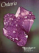 | | Journal (issue) | | Raven Hills Court, Colorado Springs, Colorado 80919 USA; tel: (303) 598-1233 66 The Mineralogical Record...occurrence is the Thunder Bay amethyst mine, at Elbow Lake, which has been in operation since 1967. Other important...temperature of 67 • B*ir^rr>pre ,RosspoV* Black LAKE SUPERIOR THU NDER, BAY A Peninsula f1/*«esota...yst McTavish Tp. H u n te r s \\L . rr o u t i LAKE S U P E R IO R deposition for most amethyst is...(1969) Geology and scenery: the north shore o f Lake Superior. Ontario Department of Mines, Geologic |  | | Report (volume) | | Alaska UNITED STATES GOVERNMENT PRINTING OFFICE, WASHINGTON : 1969 UNITED STATES DEPARTMENT OF THE INTERIOR...of Documents, U.S. Government Printing Office Washington, D.C. 20402 CONTENTS Page Abstract.. ____...kinds of rocks and minerals can be found in the roadcuts and borrow pits. The rocks include metamorphic...gold in stream channels. Tilting. Deposition of lake sediments locally. Erosion and formation of broad...the loose sand, may be seen on the faces of many roadcuts. The dune sand is mostly dark gray and is medium |  | | Journal (article/letter/editorial) | | Northern Zone, including Providence County and the northern towns of Kent County, 2) the Middle Zone, including...northern towns of Washington County, and 3) the Southern Zone consisting of Washington County and southwestern...southwestern Newport County. The greatest number of species and varieties appear in the Northern Zone. Miller...Island—for example, steatite from Johnston in Providence County for carving bowls and pipes; red and yellow ochre...(originally Hackleton's Rock) at Lincoln, Provi dence County, in 1640. Limestone was quarried there and "burned" |  | | Book | | satellite mosaic of the Adirondacks, the photomosaic of Lake George (by Richard K. Dean of Glens Falls, New York)...NY 73: Lake Placid-Underwood ... :............................................... 303 NY 86: Lake Clear...Clear Junction-Lake Placid-Jay ......................... 313 Whiteface Mountain Memorial Highway ..........Herkimer-Blue Mountain Lake ...................................... 329 NY 28: Blue Mountain Lake-Warrensburg ....Amsterdam-Blue Mountain Lake ................................... 339 NY 30: Blue Mountain Lake-Malone ....... |  | Peters, Stephen C., Blum, Joel D., Karagas, Margaret R., Chamberlain, C. Page, Sjostrom, Derek J. (2006) Sources and exposure of the New Hampshire population to arsenic in public and private drinking water supplies. Chemical Geology, 228 (1) 72-84 doi:10.1016/j.chemgeo.2005.11.020 | Journal (article/letter/editorial) | | hydrothermal quartz veins, some of which contain graphite (Rumble and Hoering, 1986). After tectonic thickening...of pegmatites and veins, some of which contain graphite. 1.2. Arsenic in New Hampshire groundwater Groundwater...or more of the following critera: presence of graphite (n = 15), abundant sulfide minerals (n = 22),...population density. Rock sample locations coincide with roadcuts along major and minor roads. 76 S.C. Peters...From a vein Contains sulfide From a mine Contains graphite 2273 794 Maximum (μg/L) 180 180 n BQL % BQL |  | | Report (volume) | | Zone UNITED STATES GOVERNMENT PRINTING OFFICE, WASHINGTON:1981 UNITED STATES DEPARTMENT OF THE INTERIOR...of Documents, U.S. Government Printing Office Washington, D.C. 20402 CONTENTS Introduction • • • •...Highway 49 (Skyway Road) near town of Abel, Cleburne County. Absaroka Supergroup/Volcanic Supergroup U ABRK03...volcanic field, Yellowstone National Park, Park County, Wyo. Academy Church Shale Member (Springer Formation)...Blocky, with interbedded brittle beds 9. Overlies Lake Ardmore Member (Springer Formation); underlies Primrose |  | | Report (issue) | | Cobalt to Temagami Northland mine Net Lake (Barton) mine Cedar Lake (Trebor, Cuniptau) mine Little Dan mine...McKinley-Darragh mine Cobalt Lake mine Seneca Superior (Cart Lake) mine Peterson Lake mine Nipissing 407 mine...Cleopatra) mine Nipissing 404 mine Mines along Brady Lake Road Right of Way (North) mine LaRose mine Chambers-Ferland...mine Foster mine Lawson mine, Conisil mine Kerr Lake (Jacobs) mine Drummond mine Hargrave mine Rochester...mine Mines along Cross Lake Road Mentor mine Nerlip mine Deer Horn (Cross Lake O’Brien) mine Smith Cobalt |  | | Report (volume) | | Mountain Wilderness Study Area and Extension, Buncombe County, North Carolina By F. G. LESURE and A. E. GROSZ...area UNITED STATES GOVERNMENT PRINTING OFFICE, WASHINGTON: 1982 UNITED STATES DEPARTMENT OF THE INTERIOR...Mountain Wilderness Study Area and Extension, Bunc1m County, North Carolina. (Geological Survey bulletin ;...studied is in the Pisgah National Forest in Buncombe County. CONTENTS Page Summary -------------------...Mountain Wilderness Study Area and Extension, Buncombe County, N.C _____________ In pocket FIGURE 1. Index map |  | | Report (issue) | | is also a road along the northern shore of Stony Lake. - Highway 134 is shown, but is not labelled. -...Bancroft and Vicinity Mining Activity Iron Corundum Graphite Molybdenum Feldspar and Beryl Nepheline Syenite...drumlin, Otonabee township. 20 21 Young anglers, Rice Lake. Coral, Echinoderm and Bryozoan fossils, Lakefield...petroglyphs north of Stony Lake. Picnicking on an outcrop of granite gneiss, Stony Lake. 31 33 Mill and plant...Burleigh Falls, Highway 28. Aerial view of Paudash Lake, Highway 28. Faraday metagabbro roadcut, Highway |  | | Journal (article/letter/editorial) | | rakovajf@miamioh.edu Fluorapatite Acushnet Quarry Bristol County, Massachusetts N orth America has produced some...Auburn, Maine. Formerly in the collection of Col. Washington A. Roebling, builder of the Brooklyn Bridge,...as the J. Keating Company stone quarry), Bristol County, Massachusetts. Rather than a granite pegmatite...chlorite, 11.5 cm tall, Acushnet quarry, Bristol County, Massachusetts. Maine Mineral and Gem Museum specimen...quarry, and Old Bluestone quarry), Acushnet, Bristol County, Massachusetts (fig. 2). I drove to the north side |  | | Report (issue) | | Emigdio-Tehachapi terrane, are exposed in large roadcuts west of the Cameron offramp of Highway 58. Mafic...Emigdio-Tehachapi mafic terrane itself are most easily seen in roadcuts in Grapevine Canyon about 5 to 7 km (3 to 4 mi...granulite can be seen in the Loop inclusion swarm in roadcuts east of the Tehachapi Loop Viewpoint on the Woodford-Tehachapi...(fig. 2) (Bear Mountain 7-1/2' quadrangle) and in roadcuts just west of Horsethief Flat (Tejon Ranch 7-1/2...conspicuous red garnet crystals and coarse shiny graphite flakes. Quartzofeldspathic gneiss is widespread |  | | Book | | told piecemeal, but in much greater detail in its roadcuts, natural outcrops, landscapes, rivers, springs...more than just a description and explanation of roadcuts and other rocks visible from a passing car. It...information concerning a couple of outstanding large roadcuts on I-79. Thanks also to Dr. C. Gil Wiswall of...ccccccccccsssssssesseseeeens T-380nSeranton—Crescent Lake. 01.2.5. cat Bisscieteets leecceoeeen US TSSAmICy...tated in natural evaporating basins like Great Salt Lake or the Dead Sea, so it is called an evaporite. Pennsylvania |  | | Report (issue) | | Maynooth Eagles Nest occurrence Baptiste Lake South occurrences McFall Lake diopside occurrence Warwickite occurrence...Selby Hill sunstone occurrence National Graphite Mine McKenzie Lake Mine Bancroft to Apsley Greyhawk Mine...Mine Silver Crater Mine Canada Radium Mine West Lake Mine Kenmac Chibougamau Mine 54 55 56 58 59 60...occurrence Padwell Mine Eagle Lake quarry Crystal Lake fluoborite occurrence Crystal Lake (Silver Crater) Mine...Mine Paxton Mine Davis Lake corundum occurrence Minden-Norland road-cuts Wilberforce Area Halo Mine Cardiff |  | | Report (volume) | | THE CITICO CREEK WILDERNESS STUDY AREA, MONROE COUNTY, / " ~ "NESSEE 1 ICAL SURVEY BULLETIN 1552 Mineral...the Citico Creek Wilderness Study Area, Monroe County, Tennessee By JOHN F. SLACK and ERIC R. FORCE,...area UNITED STATES GOVERNMENT PRINTING OFFICE, WASHINGTON: 1984 DEPARTMENT OF THE INTERIOR WILLIAM P...Study Area, in the Cherokee National Forest, Monroe County, Tenn., that is being considered for wilderness...___ Nonmetallic resources 22 22 22 23 26 27 Graphite ______________________________________ 27 gj}jca |
|


