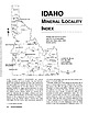
 | | Journal (article/letter/editorial) | | r------' .--. !i i , i ' i Boundary '---~ IDAHO Bonner_j l--;~u:d{ene\, I , L~ Coeur'cI'Alene...its pyromorphite, Idaho also boasts many other mineral species. ( :\.. -~:/ Idaho <....: (_ ", I...J , L r' , ( . Adams'. McCall -j' ('I. ,I) , \' ,I ',Ji Valley L..yJashingtonf ( • _ _ .l-...Power i..r v. ) 't,.,. 1. r': ~ Caribou Idaho 83816-2043 , • c-vz..J. '. 2",_J'-1 '\ o, ...INDEX BRIEFLY DESCRIBES the mineral localities in Idaho; all known localities that may have produced well-crystallized |  | | Journal (article/letter/editorial) | | US Cordillera: in situ U–Pb geochronology of the Idaho batholith Richard M. Gaschnig • Jeffrey D. Vervoort...microprobe U–Pb geochronology of zircons from the Idaho batholith and spatially overlapping Challis intrusions...99164-2812, USA e-mail: gaschnig@wsu.edu R. S. Lewis Idaho Geological Survey, University of Idaho, PO Box...Box 443014, Moscow, ID 83844-3014, USA W. C. McClelland Department of Geoscience, University of Iowa, 121...121 Trowbridge Hall, Iowa City, IA 52242, USA magmatism may reflect a combination of changes in the angle |  | | Report (volume) | | Geology of the Eldorado Springs Quadrangle Boulder and Jefferson , Counties, Colorado C_-J / By JOHN...__________________________ Boulder Creek Granodiorite__________________________ Inclusions in the Boulder Creek Granodiorite_________...rocks__________________________________________ Ralston Creek Formation.. __________________________ Morrison...Colluvial deposits.--- _________________________ Valley alluvium._____-_-_---_---_-_-_-____________ Structural...summarizing attitudes of lineations in rocks of the Coal Creek syncline_______.__________________________________ |  | | Report (issue) | | .......................................... Boulder Creek Granite.......................................mineral lineation of Precambrian rocks between Boulder Creek Granite stock and East Portal.................................... 33 7. Foliation of the Boulder Creek Granite and the Silver Plume Granite................................................. 8. Boulder Creek Granite.......................................The older granite, which is similar to the Boulder Creek Granite of other areas in the Front Range, is |  | | Report (volume) | | Utah____________________ Northern Rocky Mountains, Idaho and Mont____ Cascade Range, Wash-________________________...Utah________.____________ 6. Northern Rocky Mountains, Idaho and Mont____ 7. Cascade Range, Wash___-____.________________-...and western Utah, the northern Rocky Mountains of Idaho and Montana, and the Cascade Range of Washington...in samples from the northern Rocky Mountains of Idaho and Montana, and low strontium in those from the...MOUNTAINS / 18 x;p':- i . / S _rvf OREGON N ') I IDAHO " ' I WYOMING J T H ' I ROCKY MOUNTAINS |  | | Book (edition) | | Idaho Minerals The complete Reference and Guide to the Minerals of Idaho Lanny R. Ream 1!11, ) a...PISTOLS Idaho Minerals Idaho Minerals The Complete Reference and Guide to the Minerals of Idaho with Special...Rerun Publishing P .O. Box 2043 Coeur d'Ale ne, Idaho 83814 Copyright © 1989 by L.R. Ream Publishing...R Ream Publishing P.O. Box 2043 Coeur d'Alene, Idaho 83814 (208) 667-0453 To those collectors who are...information and specimens available to others. vi IDAHO MINERALS Acknowledgements A book of this magnitude |  | | Report (issue) | | Precambrian Qiiartzite-Schist Sequence Along Coal Creek to Idaho Springs Formation Front Range, Colorado By...Igneous rocks_ ________________________________ Boulder Creek Granite and the quartz monzonite_ _________...__________-__-__---_----_--_-_---_-Boulder Creek Granite._________________ Quartz monzonite_________-___-____-____...Geologic map of the Coal Creek areaIn pocket FIGUBE 1. Index maps of the Coal Creek area, Eldorado Springs...and cordierite. 12 4. Triangular diagram of Boulder Creek Granite.______________________ 13 5. Triangular |  | | Report (issue) | | I u The Boulder Creek Batholith, Front Range, Colorado By DOLORES J. GABLE GEOLOGICAL SURVEY PROFESSIONAL...Publication Data Gable, Dolores J. 1922The Boulder Creek batholith, Front Range, Colorado (Geological...Docs. No.: I 19.16:1101 1. Batholiths Colorado Boulder region. I. Title. II. Series: United States Geological............. Boulder Creek Granodiorite ....................... Inclusions in Boulder Creek Granodiorite............................................. Boulder Creek Granodiorite........................... Chemical |  | Sheridan, Douglas M., Maxwell, Charles Henry, Albee, Arden Leroy, Van Horn, Richard (1967) Geology and uranium deposits of the Ralston Buttes district, Jefferson County, Colorado, with sections on Paleozoic and younger sedimentary rocks. Professional Paper 520. US Geological Survey doi:10.3133/pp520 | Report (issue) | | Deposits of the Ralston Buttes District Jefferson County, Colorado By DOUGLAS M. SHERIDAN, CHARLES H. MAXWELL...Igneous rocks _________________________ ___ _ Boulder Creek Granodiorite _____________._ Quartz monzonite...Jurassic ________ -- ___ - ________________ _ Ralston Creek Formation ___________ _ Morrison Formation _______________...56 Pleistocene and Recent captures of Van Bibber Creek ________________________ _ 57 Structural geology..._____________________________ _ 61 61 63 66 68 Idaho Springs-Ralston shear zone ___________ _ Structural |  | | Report (volume) | | ......... Cross and others (1905)..... Turkey Creek Canyon Fm....... E.-cent. Front Range......... Lickus..... Lindgren and Ransome by Cripple Creek Granite at Cripple Creek. (1906). Invalid; name preoccupied;...less metamorphosed, and therefore younger, than Idaho Springs Fm., and older than Pikes Peak Granite;...granite that cuts unit is not Pikes Peak but of Boulder Creek type and age. Name applied to the "quartz monzonite...application extended by Barker (1969). Barker (1969). Idaho Springs Fm.»................. Cent. Front Range |  | | Book | | Haven, Conn.; J. Aldcn Smith, State Geologist, Boulder City, Col. An arrangement has been followed differing...crystallized at Bergen's ; Ranch, Jefferson County; on Boulder Peak. Agate,— See Quartz. — At Quartzville...Quartz Hill, Central Almandite. See Garnet. Boulder County. City Gold — Allophanite. —Franklin Mine,...in the KeyBoulder County. AMBER.— (One specimen found near the head of Cherry Creek. This may, however...AMETHYST.—See Quartz. AMIANTHITE. — North Boulder Creek. AMPHlBOLim — Occurs at numerous localities |  | | Report (issue) | | Page Abstract Dl Stations 886+00 to 977+00 Boulder Creek pluton Introduction The series ....................................................... Boulder Creek Granite .......................................................................... 5. In Boulder Creek Granite between stations 886+00 and 977+00 ...invaded by granitic plutons, which resembled the Boulder Creek and Silver Plume Granites found in other parts...susceptibility to hydrothermal alteration, the Boulder Creek Granite required more support than the Silver |  | | Report (issue) | | the Challis Volcanics in the Twin Peaks Caldera, Idaho. USGS photograph by Frederick S. Fisher. Geology...Resource Assessment of the Challis I°x2° Quadrangle, Idaho Edited by Frederick S. Fisher and Kathleen M. Johnson...mineral resources in the Challis 7°x2° quadrangle, Idaho UNITED STATES GOVERNMENT PRINTING OFFICE, WASHINGTON...resource assessment of the Challis I°x2° Quadrangle, Idaho / edited by Frederick S. Fisher and Kathleen M....I19.16:P1525 1. Geology Idaho Challis Region. 2. Mines and mineral resources Idaho Challis Region. I. Fisher |  | | Report (volume) | | Geology of Long and Bear Valleys, West-Central Idaho GEOLOGICAL SURVEY BULLETIN Prepared on behalf...Geology of Long and Bear Valleys, West-Central Idaho By DWIGHT L. SCHMIDT and J. HOOVER MACKIN CONTRIBUTIONS...Surficial geologic map of Long Valley, Adams, Gem, and Valley Counties, Idaho.____________________________...pocket 2. Surficial geologic map of Bear Valley, Valley County, Idaho. In pocket FIGURE 1. Index map of I...Meadow in Bear Valley._______________________ 18 8. Monazite placer in the Big Creek drainage southeast |  | | Journal (article/letter/editorial) | | SEPTEMBER 1969 PRECAMBRIAN ROCKS OF THE HALL VALLEY AREA, FRONT RANGE, COLORADO BY ERNEST E. WAHLSTROM...OK JOON KIM ABSTRACT The Hall Valley area, in northwestern Park County, Colorado, contains foliated highgrade...terms Idaho Springs formation and Swandyke gneiss for the metasedimentary rocks of the Hall Valley area...body of Boulder Creek granodiorite was intruded into the northeast portion of the Hall Valley area. Although...Granitic rocks 1230 Migration of elements 1230 Boulder Creek granodiorite and Silver Plume granite 1233 Pegmatite |  | Aleinikoff, J. N., Slack, J. F., Lund, K., Evans, K. V., Fanning, C. M., Mazdab, F. K., Wooden, J. L., Pillers, R. M. (2012) Constraints on the Timing of Co-Cu Au Mineralization in the Blackbird District, Idaho, Using SHRIMP U-Pb Ages of Monazite and Xenotime Plus Zircon Ages of Related Mesoproterozoic Orthogneisses and Metasedimentary Rocks. Economic Geology, 107 (6) 1143-1175 doi:10.2113/econgeo.107.6.1143 | Journal (article/letter/editorial) | | Blackbird District, Idaho, Using SHRIMP U-Pb Ages of Monazite and Xenotime Plus Zircon Ages of Related Mesoproterozoic... Abstract The Blackbird district, east-central Idaho, contains the largest known Co reserves in the United...used U-Pb geochronology of xenotime, monazite, and zircon to establish time constraints for ore formation...Merle and Sunshine prospects at Blackbird. Detrital zircon from metasandstone of the biotite phyllite-schist...4 and 1359 ± 7 Ma. Emplacement of the Big Deer Creek megacrystic granite (1377 ± 4 Ma), structurally |  | | Report (issue) | | IDAHO GEOLOGICAL SURVEY Merrill Hall, Room 332 University of Idaho Moscow, Idaho 83043 (208) 8857991............ David Hawk, representative Director, Idaho Department of Lands Stanley Hamilton ............... Chairman, Department of Geology, Idaho State University Idaho National Engineering Laboratory Clayton...................................... President, Idaho Association of Professional Geologists Deborah I...................................... President, Idaho Mining Association Jack Peterson .............. |  | | Journal (issue) | | Chair . . . . Baker Rooald K. Culbertson Myrtle Creek Donald A. Haagensen . . . . Portland State Geologist...36-009-00263 SW1f4 sec. 3 T. 5 N., R 5 W. Columbia County Pennitted; 1,655. 435 ARCO Columbia Co. 13-4-54...36-009.00264 SW1f4 sec. 4 T. 5 N., R 4 W. Columbia County Pennitted; 2,025. 436 ARCO Cav. En. Res. 13-1-55...36-009-00265 SW14 sec. 1 T. 5 N., R 5 W. Columbia County Pennitted; 1,645. 437 ARCO Oregon 34-25-66 36-007...36-007.{XX)22 SE1f4 sec. 25 T. 6 N., R 6 W. Clatsop County Pennitted; Information for contributors Oreg |  | | Report (issue) | | the Rawah batholith ........... Rocks of the Boulder Creek batholith ....... Rocks of the Mount Evans batholith...Cross C^eek Quartz Monzonite ........... Denny Creek Granodiorite ............. Kroenke Granodiorite....... Silver Plume Granite ............ Cripple Creek Granite ............ San Isabel Granite ..........(million years) in age and of the Red Creek Quartzite. The Red Creek is not conclusively dated but is interpreted...blocks separated from the Red Creek by zones of quartz mylonite. The Red Creek Quartzite consists of at least |  | | Report (volume) | | Of the Lawson-DumontFall River District Clear Creek County Colorado By C. C. HAWLEY and FRANK BAKER MOORE...northwestern part of the important Central City-Idaho Springs mineralized area UNITED STATES GOVERNMENT...of the Lawson-Dumont-Fall River district, Clear County, Colo. 2. ~ap showing major faults (veins) of the...THE LAWSONDUMONT-FALL RIVER DISTRICT, CLEAR CREEK COUNTY, COLORADO By C. C. HAWLEY and FRANK BAKER...is in Clear Creek County, Colo., just west of the highly productive Central City and Idaho Springs districts |  | | Report (volume) | | uranium in the Lassen lavas is concentrated in zircon. 207 208 3 SELECTED BIBLIOGRAPHIES OF URANIUM...proportion of minor accessories (sphene, apatite, and zircon). Part of the uranium and thorium is interstitial...Becraft, G. E., 1956, Uranium deposits of the Boulder batholith, Montana: Internat. Conf. on Peaceful...the geology of uraniferous vein deposits in the Boulder batholith area, but it has been included here for...and secondarily by an increase in the amount of zircon. The rocks of the New Hampshire magma series of |  | | Report (volume) | | Mineral Deposits of the Challis 1°x2° Quadrangle, Idaho U. S. GEOLOGICAL SURVEY BULLETIN 1658 A-S Symposium...Mineral Deposits of the Challis 1°x2° Quadrangle, Idaho Edited by D. H. MclNTYRE Papers presented at the...Mineral Deposits of the Challis I°x2° Quadrangle, Idaho (1983 : Spokane, Wash.) (U.S. Geological Survey...3:1658A-S 1. Geology Idaho Challis Region Congresses. 2. Mines and mineral resources Idaho Challis Region Congresses...Cretaceous Age and Faults in the Atlanta Lobe of the Idaho Batholith, Challis Quadrangle, by Thor H. Kiilsgaard |  | | Journal (article/letter/editorial) | | Peak batholith (Colorado, USA) revisited: A SIMS and LA-ICP-MS study of zircon U-Pb ages combined with...Peak batholith (Colorado, USA) revisited: A SIMS and LA-ICP-MS study of zircon U-Pb ages combined with...Peak batholith (Colorado, USA) revisited: A SIMS and LA-ICP-MS study of zircon U-Pb ages combined with... James Hall, Durham, New Hampshire 03824-3589, USA 2 Laboratoire de Géologie de Lyon, Ecole Normale...Cedex, France Keywords: Pikes Peak Batholith, Zircon, U-Pb ages, Hf isotopes, Proterozoic Abstract: |  | | Report (issue) | | GEOLOGY OF THE GORE CANYON-KREMMLING AREA, GRAND COUNTY, COLORADO by C. S. Venable Barclay i 1 it *v...the Boulder Creek Granodiorite -- 57 Outcrop of granodiorite-quartz diorite of the Boulder Creek Granodiorite...contaminated Boulder Creek Granodiorite--- 63 26. Float of contaminated Boulder Creek Granodiorite-...the Boulder Creek Granodiorite -- 66 28. Small spindle-shaped mafic xenoliths in Boulder Creek Granodiorite...granodiorite (-quartz diorite) near contact of Boulder Creek Granodiorite and biotite gneiss --- -------- |  | | Report (issue) | | Development and Land Stewardship—Headwaters Province, Idaho and Montana Circular 1305 U.S. Department of the...Development and Land Stewardship—Headwaters Province, Idaho and Montana By U.S. Geological Survey Headwaters...development and land stewardship—Headwaters province, Idaho and Montana: U.S. Geological Survey Circular 1305...1305, 92 p. Cover photographs. Front upper: Color Creek falls, tributary to Middle Fork Salmon River. Flowing.......17 . Geochronology and Geochemistry of the Idaho-Montana Porphyry Belt, by Cliff D. Taylor, Jeffrey |
|


